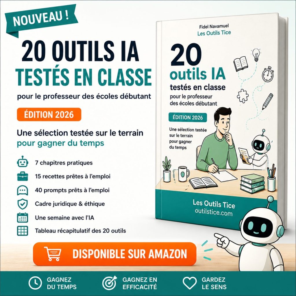
Last updated on 12 May 2026
You launch a chapter on the French Revolution, the First World War or the Roman Empire. Students remember a few dates, two names, three … places and then everything mixes up. One of the biggest challenges for them is to link an event to a specific location and understand what is happening elsewhere at the same time.
This is, among other things, what makes it possible Globe of History : a funny 3D Interactive Historical Map It displays thousands of entries (events, characters, themes) on a globe that can be rotated, zoomed in and filtered. What to put a little geography in the Chronology and make the story more “living” in class.
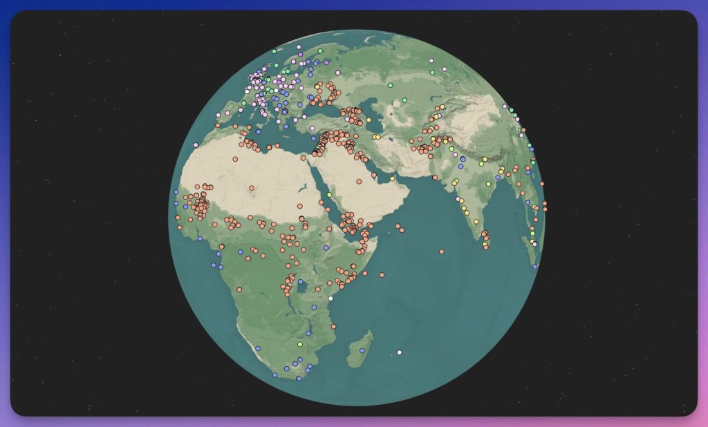
Table of Contents
Globe of History, a 3D globe of world history
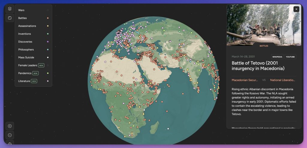
Globe of History is a Visualization Tool proposing a reading of theWorld History in the form of points spread over a 3D globe. We're sailing with a time slider at the bottom of the screen, a period is chosen and certain categories of entries (battles, inventions, philosophers, etc.) are displayed. A click on a point opens a short sheet provided by Wikipedia and Youtube as well as leads to go further.
Please note: the tool is mainly designed for use on Computer (desktop) This is good if you use it in class for use in class with video projector/TNI.
Features to find your way around (and how to avoid the “too much info” effect)
The first time you can feel overwhelmed: Points appear everywhere. The right reflex is to frame exploration. Here's how to do it in three simple steps:
1) Reduce the period (to make the map readable)
Use the time bar at the bottom of the screen, instead of “from antiquity to today”, you can choose a “shorter” interval:
- 1490-1550 for the Great Discoveries;
- 1780–1820 for revolutions;
- 1914-1919 for the First World War;
- 1933–1945 for the rise of totalitarianism and the Second World War.
You instantly move over the world map from a “point cloud” to something more actionable.
2) Filter by theme (to give an angle)
To do so, click on the small menu at the top left of the screen. Voius pouve allors choose to show only a few categories among the ten proposed. I like the one dedicated to literature or the one dedicated to famous women. Note that each category inherits a colour, which also allows you to better identify yourself among the many points displayed on the map. The aim is not to show everything, but to make a reading emerge: conflicts, advances, figures, explorations … This filter transforms the tool into a pedagogical magnifying glass.
3) Zoom into a … area and make the map speak
Once an area is displayed, the tool becomes interesting when it is treated as a questioning medium:
- Why is this territory concentrating events on this period?
- What changes if the 20-year time window is shifted?
- What do we see if we go from ‘battles’ to ‘inventions’?
This is where students stoplook at a map” and can start interpret.
Globe of History ticks three useful boxes in history-geo: it helps to situate, link and contextualise events in time and space, while quickly putting students into activity through guided exploration and pairing exchanges. It also naturally opens up to the IMS, inviting to ask where the information comes from and to verify it.
Three concrete uses (ready to unfold)
1) Chapter start-up: “3 points to understand the period” (10–15 min)
- You display a period (e.g. 1914-1919) and zoom in on Europe.
- Students identify three points:
- a military event;
- a political event;
- an event outside Europe, over the same period.
- For each point: where? when? why is it important?
Possible production: mini-crisis in the table (3–5 benchmarks).
2) Mini-survey: ‘one point, two sources, one synthesis’ (30–45 min)
- Each group chooses a point on the globe.
- He has to find two sources complementary (manual, institutional resource, … documentary article).
- Production (optional):
- 10 lines of summary;
- a frieze of 5 dates around the event;
- a simple and captioned card.
3) Writing (history + French): "Tell from a place" (45 min)
Instructions: write 200–300 words (logbook, letter, flash info…) including:
- a location marker (where the scene takes place);
- a time mark (period/date);
- two verified facts (sources noted).
I like / I don’t like
I like
- Very visual : perfect for hanging a class at the beginning of the sequence.
- Excellent marker support : connect “when” and “where” in a single gesture.
- NDE without heaviness : the tool naturally invites cross-checking.
I don’t like (or limit)
- Rather “desktop” : on mobile/tablet, it is less comfortable. In class, the ideal is the computer + projection.
- Risk of overload : without framing (period + theme + area), exploration may become sketchy.
- Language barrier : the interface and/or part of the information is in English, This may hold back some students.
- To be cross-checked : thinks of the tool as an unusual gateway. For a solid session, it is of course necessary to supplement with resources aligned with the programs.
An original resource to hang students
Globe of History does not replace a course. Rather, it serves as a trigger. In a few minutes, you can locate an event, raise questions, launch a mini-survey or a writing activity. Nice to meet you.