Last updated on 12 May 2026
Paristique is a An impressive online map showing the origin of most of the streets and places in the French capital with a click.
A free interactive map created by a passionate This is a good example of what can be achieved through the rise of open data and visualisation tools. Open data is a philosophy to make digital data accessible to all and to overcome restrictions on the right of access and re-use. It is part of a trend that sees public information as a common good.
Paristique is the work of Guillaume Derolez who was looking for an imposing dataset on Parisian streets in the website of the Open Data policy of the City of Paris, ParisData which is also worth a visit.
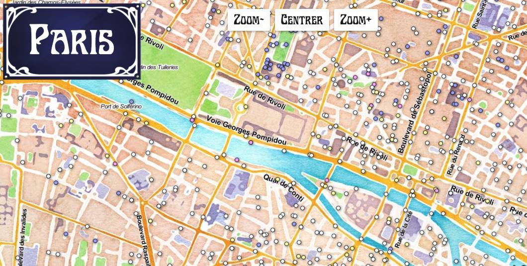
The result is great. Paristique offers you a beautiful watercolour map of Paris from the Google Maps collection in which thousands of coloured dots appear. You will be able to walk around at your leisure and zoom in on the corner of the capital that interests you. The colour of the dot indicates its nature: streets in white, squares in yellow, pedestrian streets in blue etc …
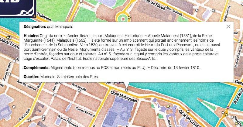
By clicking on a dot you get the origin of the street name and a quick story. Oh, owl.
It's up to you. Paristique is free and without advertising.
Link: Paristique
I heard about it on tele-morning on 2
Superb! When is the app version for teléphone, to cultivate while strolling in the city?
Congratulations!