Last updated on 12 May 2026
 Long, long before Google Earth, Long before GPS and the invention of digital mapping, scientists spent entire lives gathering all the knowledge about paper manuscripts. Urbano Monte, a 16th-century Milanese scientist, published a 60-page manuscript with the ambition of mapping the entire earth. A jewel dating from 1587. Scientists from Stanford University have just digitised the plates of this manuscript and assembled them to reconstruct a global map. The largest map in the world. The result is beautiful.
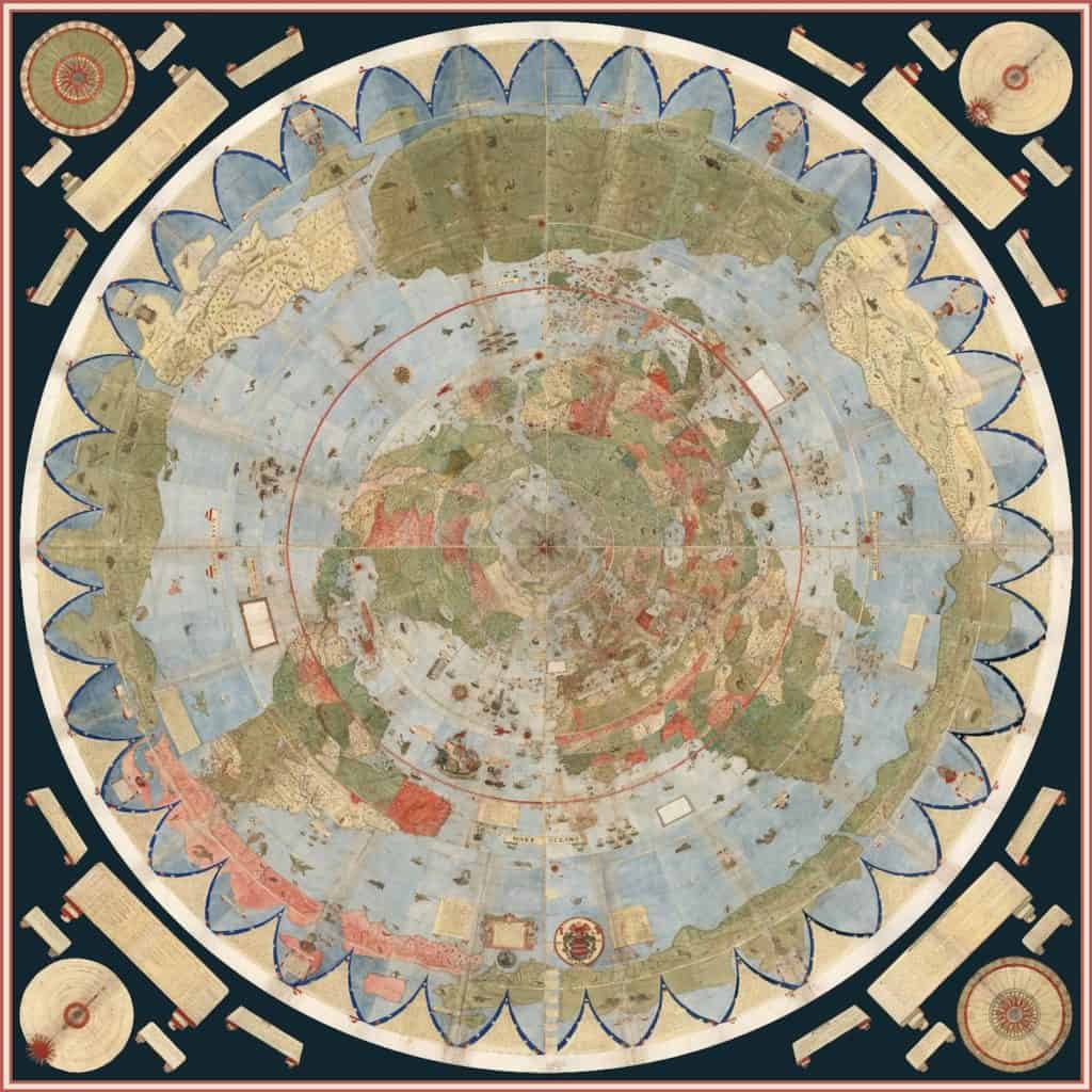
Stanford cartographers used computers to assemble the boards precisely on a flat map, but also on a 3D hemisphere. Rich idea. The hand-drawn map still questions many specialists for its richness and precision.
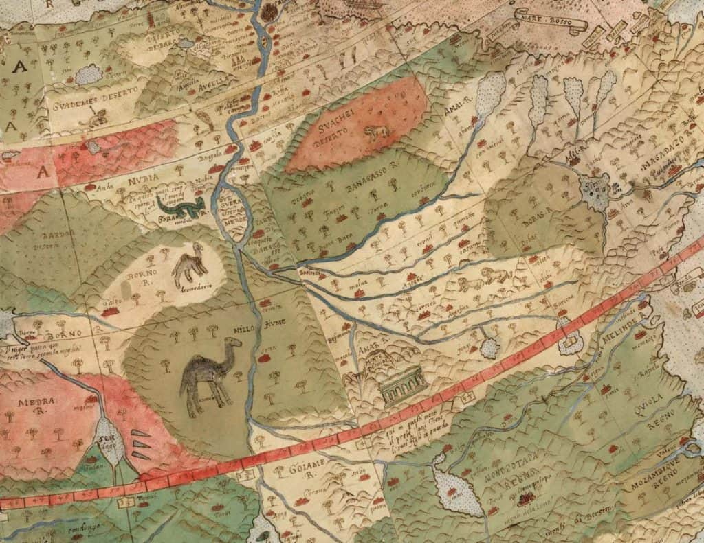
For example, you can discover an extremely precise Japan built probably thanks to the official visit of a first Japanese delegation a few years earlier. It also shows the islands of Tierra del Fuego in South America, which Ferdinand Magellan, the Portuguese explorer, had discovered in 1520. We also fly over lesser-known areas such as Central Africa or distant seas where we discover sea monsters and sinking ships.
This computer reconstituted atlas measures nearly ten square meters. Huge, huge indeed.
The digitized map consult online in high definition board by board.
The video made on this occasion of this Mappemonde rises from the past has enough to make forget all the declinations of Google Earth.
The Stanford Library published a very comprehensive brochure in which she reviews this work of putting Urbano Monte’s immense work into perspective. You can download it below. It is free, but unfortunately only in English.
Link: Stanford Library Brochure.
A reader has just sent me a link to an article in ‘LiveScience’ which sheds new light on Urbano Monte’s work. Between genius and copier …
It is not the oldest map of the world because there are two maps of the world from the 8th century: ‘La Mappa Mundi du Vatican’ and ‘La Mappa Mundi d’Albi’ in the Tarn registered by UNESCO since 2015.